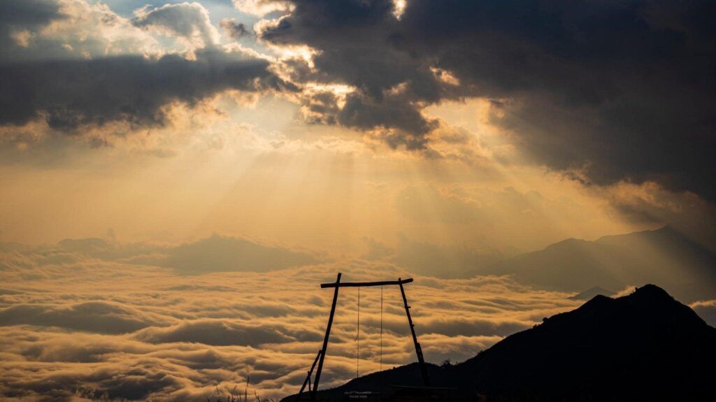
Ky Quan San, also known as Bạch Mộc Lương Tử, is the fourth-highest mountain in Vietnam. It is famous for its sea of clouds that roll between the mountains and hills. This is also a memorable trekking route in the North that you should try once if you have the chance. In the past, this mountain was also called by another beautiful name, Bạch Mộc Lương Tử. However according to the locals, Ky Quan San is the official name of this mountain range.
Bạch Mộc Lương Tử is a name that trekkers gave themselves when they conquered the mountain in 2013. At that time, trekking groups took steps to explore the path to the top of the mountain in different directions (from Phong Tho, Lai Chau and Bat Xat, Lao Cai). Therefore, there is confusion that the mountain originates from the nearby Bach Moc Luong mountain – a mountain range located near the Vietnam-China border in Phong Tho district, Lai Chau with the peak named Po Ma Lung (Bach Moc Luong), 3,000m high.
However, to be precise, it belongs to the Ky Quan San range (according to the pronunciation of the locals), which was recorded by the French on the old map with the name Ky Kouan Chan.
Initially, their target was the Bach Moc Luong peak (Po Ma Lung) but they got lost and went to Ky Quan San. After agreeing, people named the mountain Bach Moc Luong Tu to distinguish it from Bach Moc Luong (Po Ma Lung).
Geography Location to Ky Quan San
Ky Quan San, also known as Bach Moc Luong Tu, is located in the border area between the two provinces of Lao Cai and Lai Chau. With an altitude of about 3,046m, Ky Quan San is famous for its majestic scenery, the most beautiful among the mountain peaks in the Northwest region.
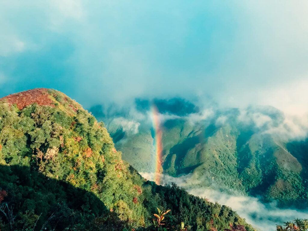
Best time to trek to Ky Quan San
Trekking Bach Moc Luong Tu from Lao Cai direction
People often trek Bach Moc Luong Tu in the summer to avoid rain during the trek. However, trekking Bach Moc Luong Tu in the summer will be very sunny, which can easily cause heatstroke and dehydration. Therefore, you can choose to climb Bach Moc Luong Tu from the end of August to April because the weather is cool at this time, not too cold or too hot.
In particular, trekking Ky Quan San in April, you will have the opportunity to see rhododendrons near the top of Bach Moc Luong Tu. So, March – April is also an ideal time to go trekking

Trekking Ky Quan San in winter is also an extremely interesting experience when you can see the snow falling on the mountains, playing in the snow, especially when the snow covers the mountain white, making the viewer unable to look away.
Trekking Bach Moc Luong Tu from Lai Chau direction
In Lai Chau, you can climb Bach Moc Luong Tu between mid-spring and mid-summer. Because the vegetation here is lush, the path is mainly in the forest, so trekking in the summer is also quite interesting.
If you have the time and conditions, I think you should go one way and one way to have the opportunity to experience two different landscapes (terrain, climate, forest trees, clouds, sky, …) to make your trip more interesting
How to go to Ky Quan San
There are two ways to get to the foot of Ky Quan San mountain, one is from Lai Chau and the other is from Lao Cai.
Lao Cai: Hanoi – Sapa town – Sang Ma Sao.
From Hanoi, you can take a sleeper bus/train to Sapa. Book the BUS. When you arrive in Sapa, you can rent a motorbike and ask for directions to Sang Ma Sao. However, if you are traveling in a large group (10-16 people), you should rent a 16-seater car to ensure safety, save costs, and avoid having to carry a lot of luggage. (1500 – 1700k)
When you arrive in Lao Cai, contact the group’s Porter. Usually, the Porter will wait for you at Muong Hum market to go shopping.
Lai Chau: Hanoi – Lai Chau bus station – Den Sung.
From Hanoi – My Dinh bus station and then rent a sleeper bus to Lai Chau bus station. When you arrive at Lai Chau bus station, you can go to Den Sung by 2 ways:
Option 1: Take a Muong Te bus to the intersection of Muong So and then take a motorbike taxi to Den Sung
Option 2: Take a motorbike taxi directly from Lai Chau bus station to Den Sung (300k).
Trekking route of Ky Quan San
Day 0: Hà Nội – Sapa
22:00: Sleeper bus to Sapa
Day 2: Sapa – Shelter 2100
05:00: Arrive in Sa Pa, check in to the hotel, rest and take care of personal hygiene.
07:30: Go to the trekking point at Ky Quan San village, 60km from Sa Pa.
09:30: Arrive at the gathering point, you leave your luggage to the Porter (porter). You take a motorbike taxi through the first steep slope.
10:00: The group starts the trekking journey.
11:30: Have lunch at the beginning of the bamboo forest.
17:30: Arrive at the campsite at an altitude of 2100m, you rest after the first day’s journey.
18:30: Enjoy dinner, then spend the night in a shelter with blankets and a heat-insulating mattress to keep warm.
Day 3: Ky quan san 3046
05:30: Wake up and move to Muoi Mountain to watch the sunrise and returns to the campsite for breakfast with coffee or ginger tea.
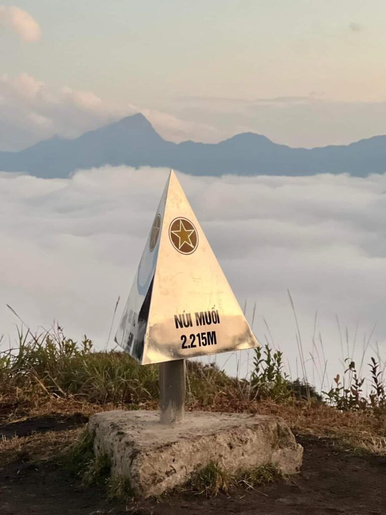
07:30: Warm up and start the final leg of the journey.
12:00: Reach the top of Ky Quan San, the group rests, takes photos, and enjoys the scenery on the top of the mountain.
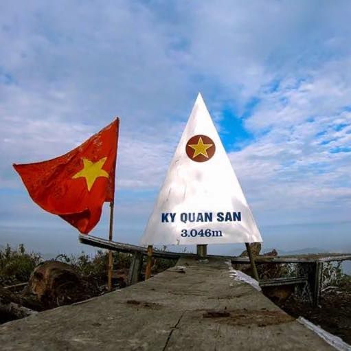
13:00: Have lunch
16:30: Arrive back at the shelter, the group rests and enjoys dinner.
Day 4: Ky Quan San – Sapa – Hanoi
5:30 AM: watch the sunrise on Muoi Mountain or sleep
7:00 AM: Have breakfast and pack the belonging and start to move down
12:00 PM: The group will arrive at the foot of the mountain and then take a motorbike taxi to the porter’s house to rest and have lunch.
2:00 PM: Go back to Sa Pa.
5:00 PM: Enjoy a Red Dao herbal bath or a 30-minute foot massage.
7:00 PM: Enjoy dinner
11:00 PM: Board a sleeper bus to return to Hanoi.
4:30 AM: Arrive at the original meeting point.

